Sunday, July 16, 2017

Diamonds Are Forever - or at least 60 years of marriage

I celebrated, with many of my family members, my parents 60th wedding anniversary in Yellowstone National Park.  Yes, 60 years!  Yellowstone was fitting because my parents not only went their for their honeymoon but they go just about every year.  It was certainly the genesis for my love of the outdoors.  While there was more silver (or grey hair) than diamonds it was a lot of fun.

Our most dependable yearly activity is taking a family picture at Artist Point with the Lower Yellowstone Falls in the background.  Here's the whole passel of family that came (4 generations represented) - and we even all had our eyes opened and smiles sparkling like diamonds!
That's Us!

Of course we needed to do some fishing.  Our fish ranged from over 100 little gems to some big lunkers:
Little Brookie
My brother with a big cutthroat

Animals are always abundant and even though the weather was hot for early July we did manage to see a wide variety of animals, even a coy grizzly bear - all looking stronger than ever.
Grizzly
Fox
Okay, this mountain goat may not look strong but she is - she's just shedding!

I took my nieces and nephews up Mt. Washburn which showed just how durable they all were.  It was fun to see baby mountain goats and a fox walking right beside us!
On Top Of Yellowstone
View of Grand Canyon and Hayden Valley
And, I had the chance to stop and take some pictures of a few sparkling waterfalls:
 Gibbon Falls
Big Falls (now Upper Mesa Falls)

All in all it was an amazing trip and I'm so thankful to both my family for helping celebrate this major milestone to my parents for creating such a good example for me.  I'm not sure there will be 60 more (eek!) but, Mom and Dad, may the rest of your years continue to be happy and adventurous!
Great Fountain Geyser
Mom and Dad watching Old Faithful

You can view additional pictures in my Public Gallery. All pictures are available for purchase.

Thursday, June 15, 2017

I found the Far Side - at the Manhattan Project

I grew up in Richland, Washington which is where part of the Manhattan Project occurred.  In fact, the world's first nuclear reactor was built here.  And before you ask...no, I don't glow in the dark (at least not that much! HA).

The NPS started having tours out to "the site" as it is locally called.  I was especially interested because my father worked out at "the site" for decades and I was never able to go see where he worked or even hear about much of what he did. This reactor was long defunct before we arrived in Richland but it still gave me an idea of what my Dad worked on.  

The B-Reactor
My Mom and I at the reactor front

After a 45 minute drive out into the desert we arrived at the B-Reactor.  The reactor was developed by Dr. Fermi in Chicago.  Materials came from Oakridge, Tennessee to Richland and then once the uranium was made in plutonium it was delivered to Los Alamos, New Mexico.

I wonder what this knob does?!

This made me laugh - one of my favorite finds.  A hacksaw with a serious extender.  

As a female engineer I was looking for the female influence for developing this technology.  Well, of the 40,000 employees only 4,000 were women.  They were mostly used for safety parades where managers would pick a "Queen of Safety" and the guys would attend to see who was selected.  I'll admit this sounds (is) sexist.  That being said a really cool thing I learned was that the second in line for the technology development was a woman physicist - Leona Woods Marshall who was Dr. Fermi's grad student.  In fact, when they built the reactor there wasn't even a woman's restroom but the men respected her so much they took the last stall and made a bathroom just for her.  While it doesn't negate the Queen of Safety, it did make me proud of Leona and her technical input and fortitude  to working with all those men back in the 1940's.  
Queen of Safety

The same people who built the reactor wrote this sign...makes you think twice?!

It was really neat to see the wall where the uranium was loaded with all of the cooling piping, the control room and the complexity of this big technical advancement.  It certainly wasn't optimized but the fact that it worked was amazing.  And, while there I found "the far side." Sorry Mr. Larsen! 


For more information on the tour you can go to the national park service Manhattan Project.

Monday, April 3, 2017

Kanab Hiking Cheat Sheet - cuz I'm just not that lucky!

Hiking is one of my passions, and hiking slot canyons is definitely high on my list.  For spring break my friend Mark and I hit the trails near Kanab, Utah.  Most people go to the famous hike "the Wave."  Ever since Microsoft put it as a screensaver it is so popular that the BLM limits entry to just a handful of lucky people who win a lottery system.  As someone who has never won anything in a drawing - EVER - I figured my chances were slim to none.  I was right on that account - 4 days straight with no luck.  But, knowing my lack of luck we had planned other opportunities.  My favorites are below.

Wire Pass/Buckskin Gulch
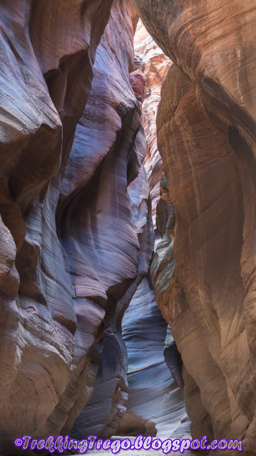
This is by far one of the most spectacular slot canyons.  It is touted to be the longest slot canyon in the world.  It is about an hour east of Kanab.  A few years back I hiked Wire Pass and at the confluence of Buckskin Gulch I turned left (Slots - and I'm not talkin' bout Vegas).  This year I turned right and this is a much better option with more crevices twisting and turning through tight and tiny passages.  There are times of the year where wading through water is required but with no rain for the past week we walked about 2.5 miles past the confluence with no wading required.

We started at Wire Pass, awe-inspiring with the height of the walls, the tightness and the twists of rock.  Within a few feet of entry there is a large 12-15' drop.  Many people bring ropes to shimmy down.  That's the hard way.  Actually, just at the entrance of the slot canyon there is a small goat trail on the right side which allows you to rock scramble around.  This is an easy scramble and you are back into the slot in only 10 minutes.  It is way worth the scramble to not have to carry rope with you!  The other thing I like about this little bypass is that you get to see into one area of the slot canyon from above.
View into Wire Pass


With such narrow passage ways it is quite cold in the slot but about every half mile or so there are some bigger openings where sun filters down to the bottom and you can warm up.  I love this hike!


I hope I'm skinny enough to fit!

I'm glad I wasn't around when that logged jammed up there - high water!


After a long hike my favorite restaurant to refuel in Kanab is Escobar's.  Just be warned...it isn't open on Saturday or Tuesday of all weird days to be closed!

Paria History
There are a couple of short hikes in the Paria area which are fun and have some pretty cool sights.  Right off of 89 are the Toadstools.  The fun part about these hoodoos is you can walk right up and around them without being on a guided pathway.  Except for the electrical poles and freeway sounds you feel like you are in the wild (okay, not really). 

Next is a small hike to the Nautilus.  After walking up a dry riverbed for about a mile you come to this crazy rock formation that is in the shape of a nautilus.  Apparently the top fell down a few years back but it still interesting and bigger than you think as you walk through it. 

Swirly Whirly! (Thanks to Mark for the pict on the left)
Finally, the painted hills create a unique backdrop to some pioneer ruins.  Many of the painted hills can be seen right from the dirt road.  This is what I would advise.  Mark and I decided to be adventurous and trek over to get a closer look.  This wasn't a very good decision it turns out.  Let's just say that its a good thing that I know how to get out of a sink hole...the rest of the hike was a little squishy and muddy for some reason!? 


Coral Pink Sand Dunes
The sand dunes allow you to feel like your in a desert...wait...you are in a desert!  It is a few miles of large dunes as high as 100 feet high.  I brought a sled and some folks had snowboards, just make sure to wax them so you actually slide.  I didn't slide.


Red Canyon - Peek A Boo Slot
Timing couldn't have been better to hit Red Canyon, just a few miles north of Kanab.  This slot canyon requires you to hike (or drive if you can handle it) 3 miles through seriously deep sand to the mouth of the slot canyon.  By the time we got to the mouth of the canyon the sun was just at the perfect angle to filter down into the canyon and create some amazing colors.  The slot isn't very long and it isn't nearly as deep as Wire Pass but that allows the sun to beam in a give you the rich red coloration southern Utah is famous for.


We were also lucky enough to run into a really nice local who gave us a ride back in her jeep (Thanks Denise).  The 15 minute better than Disneyland ride vs. 120 minutes of hiking in the hot sand made our day!
My friend Mark taking some pictures - yes, this is the true color!


No, we didn't hike the wave but it wasn't for lack of trying.  In the end, these other options provided beautiful hikes which I'm sure I'll do again while I wait to find my luck.

You can view these and additional pictures in my Public Gallery or by clicking on the Photo Gallery Tabs above. All pictures are available for purchase.
 

Thursday, October 13, 2016

An Uphill Battle: Avalanche Peak

As a kid I was jealous that my brother went on a hike to summit Avalanche Peak in Yellowstone National Park.  I was too young to go at the time and by the time I was old enough the park system had stopped doing ranger led hikes.  I always looked across Yellowstone Lake at that peak wondering what the view was like from up there and thinking it was the one that got away.  Well...not so anymore!
This summer for the 100th anniversary the NPS brought back a lot of their guided hikes so I took advantage and hiked to the top of Avalanche Peak.  Located on the eastern border, Avalanche Peak is one of the highest peaks of the park at 10,568 feet and is rated as the toughest hikes in the park rising 2100 feet in just over 2 miles. And I'll say this - there aren't a lot of switchbacks!

We started the hike on a beautiful morning with a group of 8 people...with only 2 of them being from the US. I felt a little out-numbered! When in large groups you tend to move much slower than if you were on your own but this group did a decent job of walking at this high elevation.  We made it to the summit in about 2.5 hours and then descended in 1.5 hours.  The first half of the hike is in a lush wooded area with wildflowers and a stream.  You have to watch where you walk though as it is loose gravel on top of a dusty trail.  The last half of the walk is in sharp contrast to this as it is on shale above the tree line. 


Along the way we saw marmot and deer! 
The best reward however was the spectacular vista of the greater Yellowstone region.  It was breathtaking (in more than one way!) and I don't have to wonder what the view was like anymore.  It's definitely a great hike which I would recommend to people.


You can view these and additional pictures in my Public Gallery or by clicking on the Photo Gallery Tabs above. All pictures are available for purchase.